

Migraciones Pelágicas | Marcas Satelitales
Pelagic Migrations | Satellite Tagging
PATRONES DE MOVIMIENTO DE LA MANTA GIGANTE OCEÁNICA Y DEL TIBURÓN BALLENA EN EL PARQUE NACIONAL REVILLAGIGEDO, GOLFO DE CALIFORNIA Y EL PACÍFICO MEXICANO
Resumen
Este estudio empleará el uso de etiquetas de satélite para registrar los movimientos de los tiburones ballena (Rhincodon typus) y de las mantas gigantes oceánicas (Mobula birostris) del Patrimonio Mundial de Parque Nacional Revillagigedo, el Golfo de California y Thetis Bank frente a la costa de la Península de Baja California, para evaluar hasta qué punto estos peces carismáticos ocurren en áreas protegidas, montes submarinos y su patrón migratorio. Nuestros resultados ayudarán en los esfuerzos de conservación generados.
Para mayor información, colaboraciónes o donativos relacionados a este proyecto favor de contactar a Erick Higuera - higuera@pelagiclife.com o Dení Ramírez Macías (Whale Shark México) tiburonballena@gmail.com
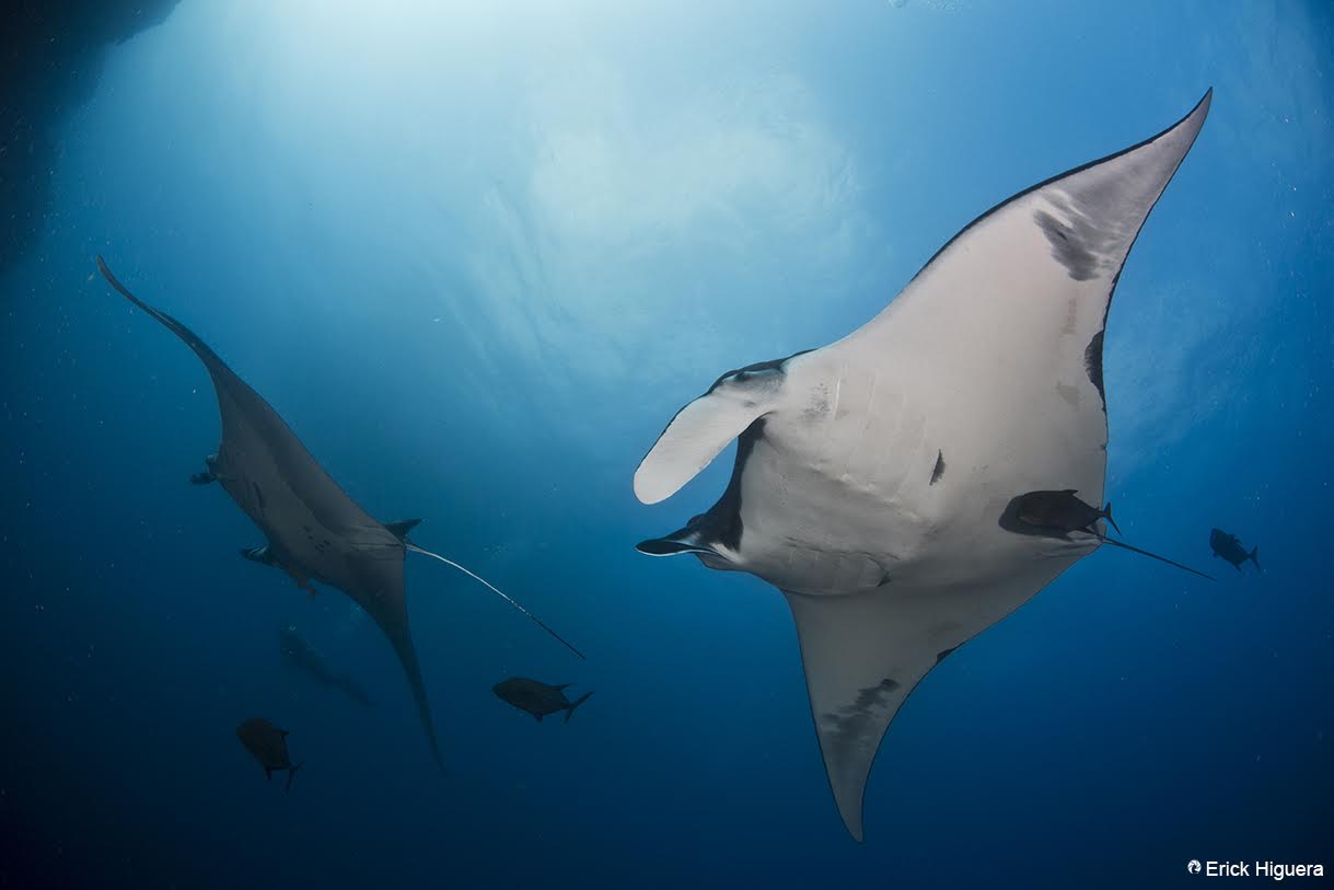
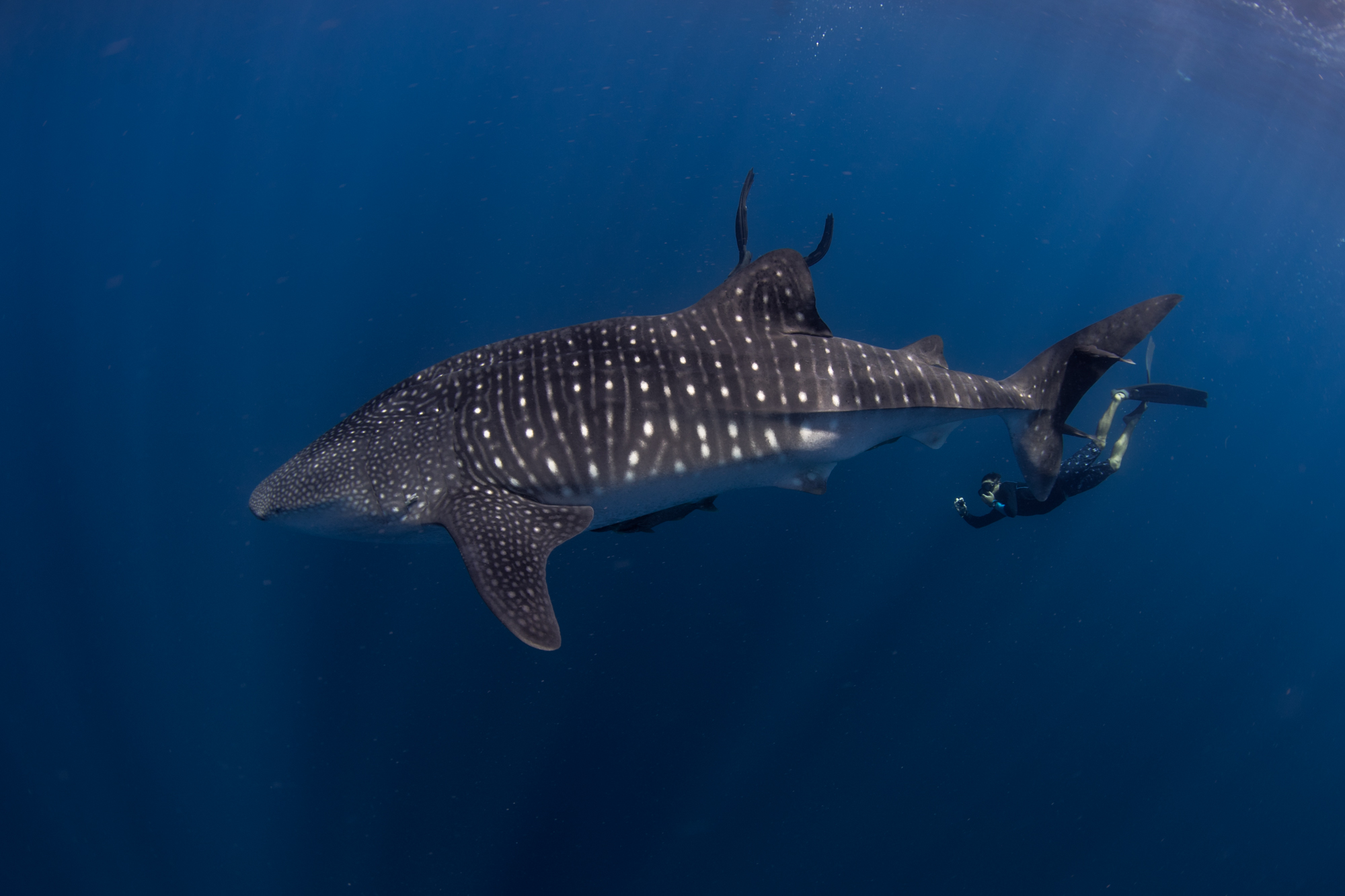
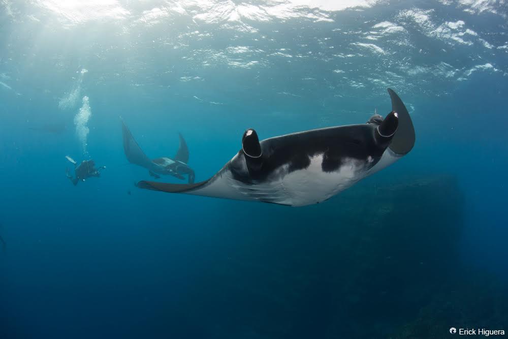
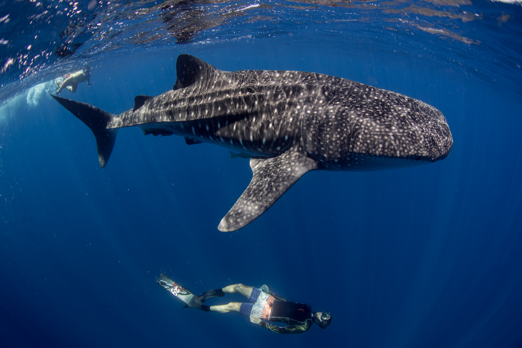
MOVEMENT PATTERNS OF THE OCEANIC GIANT MANTA AND THE WHALE SHARK IN THE REVILLAGIGEDO NATIONAL PARK, GULF OF CALIFORNIA AND THE MEXICAN PACIFIC
Summary
This study will employ the use of satellite tags to record movements of Whale Sharks (Rhincodon typus) and Oceanic Giant Mantas (Mobula birostris) from the UNESCO World Heritage Site Revillagigedo National Park, the Gulf of California and the Thetis Bank off the coast of the Baja California Peninsula, to assess the extent to which these charismatic fishes occur in protected areas, offshore seamounts and their migratory pattern. Our results will help in generated conservation efforts.
For more information, colaboration or donations related to this specific project please contact Erick Higuera - higuera@pelagiclife.com or Dení Ramírez Macías (Whale Shark México) tiburonballena@gmail.com
Resultados
Una base de datos que contiene: 1) Rutas seguidas de tiburones ballena y mantas etiquetadas, 2) Una base de datos del período de estudio (2017-2018) obtenida para las diferentes áreas de estudio como temperatura del océano, concentración de clorofila, viento y mareas, 3) escrito informar a las autoridades mexicanas, con las estrategias de conservación propuestas para estos peces carismáticos y su hábitat. 4) Desarrollo de una campaña pública sobre nuestro proyecto, informando al público en general a través de nuestro sitio web, páginas de redes sociales y a través de nuestras noticias usando video y evidencia fotográfica.
Outcomes
A database containing: 1) Routes followed by whale sharks and mantas tagged, 2) A database of the study period (2017-2018) obtained for the different areas of study such as ocean temperature, chlorophyll concentration, wind and tides, 3) written report to the Mexican authorities, with proposed conservation strategies for these charismatics fishes and their habitat. 4) Development of a public campaign about our project, informing the general public through our website, social media pages and through our news using video and photographic evidence.

En Colaboración / In partnership with


Más Información / More information
Visión de conjunto
El sitio UNESCO Patrimonio Natural de la Humanidad Parque Nacional Revillagigedo es un grupo de 4 islas volcánicas conocidas por su ecosistema único, ubicado en los límites de dos regiones marinas: el borde oriental del giro del noreste del Pacífico hacia el noroeste y el este del Pacífico tropical hasta el Sureste. Está sujeto a la influencia de masas de agua formadas en dos sistemas de corrientes principales, la corriente californiana y la contracorriente ecuatorial. El Banco Tetis está ubicado frente a la Bahía de Magdalena en la Península de Baja California, México. Hay una abundante vida marina que rodea ambas islas debido a la topografía submarina y las corrientes oceánicas. Debido a la amplia distribución de estas especies carismáticas y porque son altamente migratorias, es necesario determinar sus movimientos en el Pacífico Oriental y conocer la conectividad con otras áreas, para ayudar a identificar la existencia de corredores biológicos y determinar qué áreas son más necesitadas de protección, por lo tanto, para desarrollar estrategias de conservación a nivel local o internacional. La última declaración podría lograrse utilizando marcas satelitales. Se colocarán marcas satelitales sobre tiburones ballena y mantas gigantes en el Parque Nacional Revillagigedo, en el Golfo de California y en el Banco Tetis. La capacidad de movimiento determina que una población puede distribuirse en un área amplia y sus miembros visitan hábitats diferentes que muestran una mayor fidelidad a hábitats críticos (Ejemplo: aquellos en los que las condiciones alimentarias y / o ambientales maximizan la probabilidad de supervivencia de los recién nacidos), por lo que Es importante obtener información que defina el hábitat crítico de ambas especies (aquellas en las que se favorece la supervivencia y el potencial alimenticio), en base a estudios que demuestren la disponibilidad de alimentos.
Metas y objetivos
El objetivo del proyecto es identificar a los tiburones ballena y las mantas gigantes en el Parque Nacional Revillagigedo y en la isla de Cerralvo con el fin de registrar su perfil de natación y sus movimientos.
Esta información ayudará en el programa de manejo del tiburón ballena mexicano y las estrategias de conservación para las Islas y estas especies en peligro de extinción.
Objetivo específico 1
Determinar las rutas migratorias de estos peces carismáticos del Parque Nacional Revillagigedo, Isla Cerralvo y Banco Tetis. La determinación de las rutas migratorias ayudará en las estrategias de conservación de estos peces. Por ejemplo, ¿necesitamos estrategias de conservación locales o internacionales?
Objetivo específico 2
Para evaluar las condiciones oceanográficas y atmosféricas específicas que influyen en la presencia de estos elasmobranquios en el Parque Nacional Revillagigedo, Isla Cerralvo y Banco Tetis, evaluar el grado en que estos peces carismáticos se producen en las áreas protegidas.
Las evaluaciones para identificar el hábitat crítico para la especie, proporciona el vínculo de modelos que integran datos de población como abundancia, fidelidad, estructura de tamaño y sexo, más las condiciones de productividad en cada área, por lo que también los planes son obtener datos sobre productividad, oceanografía y condiciones atmosféricas.
Objetivo específico 3
Brindar información al gobierno mexicano para que pueda desarrollar planes de conservación y manejo para estos peces.
Razones
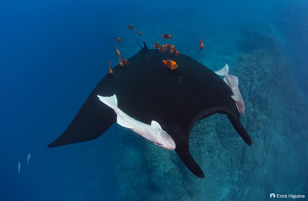
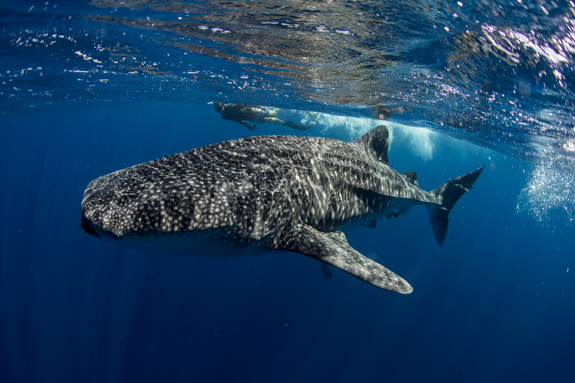
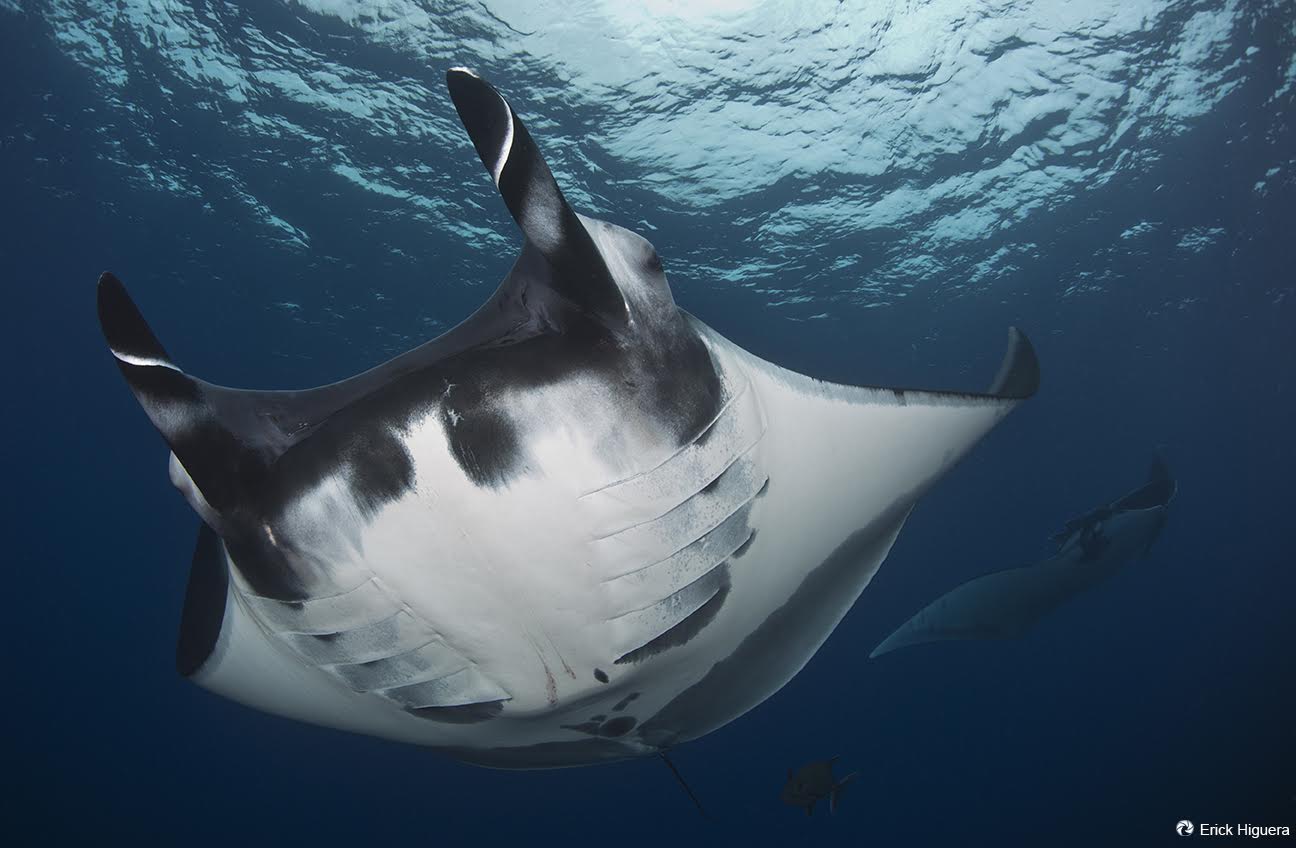
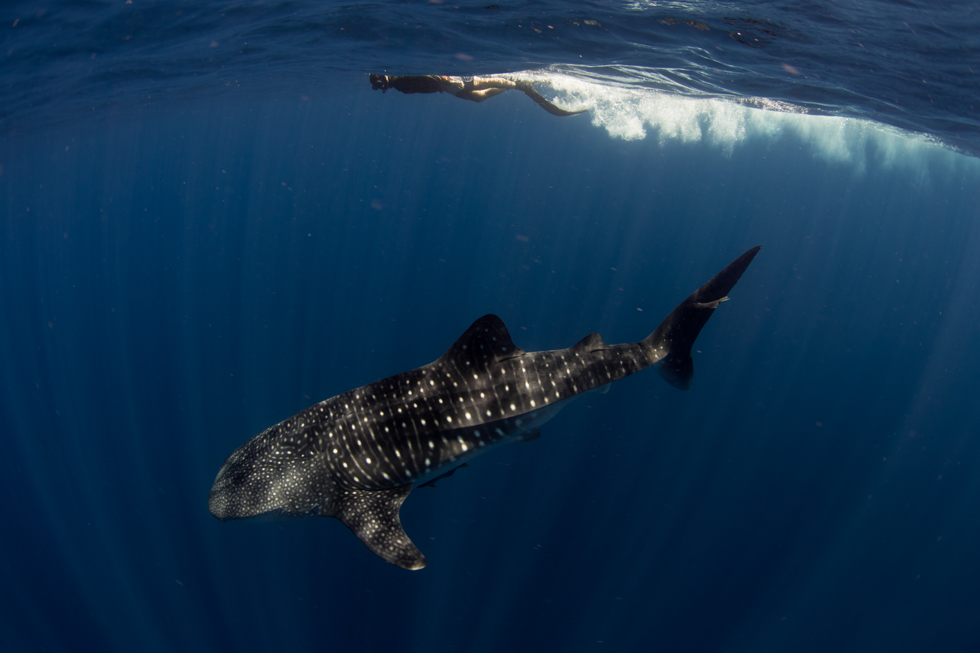
El tiburón ballena y la manta gigante oceánica son elasmobranquios filtradores con una distribución epipelágica circumtropical. En algunos países, estas especies constituyen un recurso pesquero y en otras un recurso turístico. Por lo tanto, la explotación sostenible de estas especies depende del conocimiento de sus poblaciones, que es limitado. Ambas especies, debido a sus características biológicas de crecimiento lento, madurez sexual tardía y poblaciones pequeñas, las declaran en peligro y vulnerables según la Lista Roja de la UICN para la Conservación de la Naturaleza, además de que también están incluidas en el Apéndice II de la CITES Convención sobre Comercio Internacional de En Peligro Especies. En México, el tiburón ballena está bajo la protección de la Norma Oficial 059-SEMARNAT declarando que es una especie amenazada y la Manta gigante del Pacífico está clasificada por la NOM-029-PESC-2006 bajo protección especial. Este estudio basado en etiquetas satelitales proporcionará información vital sobre sus movimientos y el uso del hábitat necesario para las estrategias de conservación.
Actividades
Objetivo 1
Este es un proyecto de 1 año (2018-2019). Cinco tiburones ballena de Revillagigedo, Golfo de California y Banco Tetis y 5 mantas (2 de Revillagigedo y 3 de Isla Cerralvo y alrededores) serán marcados con SeaTag-LOT. Estas son marcas compactas de 132 mm x 13 mm y un peso de 29 gr. Estas marcas de alta tecnología registran información sobre la hora del amanecer y el atardecer, la temperatura y funcionan como el GPS en la superficie, los datos se recopilan y almacenan en la etiqueta por un período de tiempo de hasta un año. Las marcas serán programadas para ser lanzadas después de 6 meses, luego saldrán a la superficie, enviando toda la información a través del PTT al satélite Argos. La marca se colocará en la base de la aleta dorsal de los individuos que usan equipo SCUBA y un arpón con una punta modificada sujeta con un clip a la aleta dorsal, en el caso de las mantas, las etiquetas se colocarán cerca de la aleta dorsal .
Los datos de SeaTag- ° © -LOT, incluidas las pistas estimadas por ubicación geográfica, son procesadas y entregadas directamente por Argos CLS, el proveedor de servicios satelitales. Aprovechando sus amplias capacidades, CLS combina esta información con otros datos sensoriales satelitales, como la temperatura de la superficie del mar, para proporcionar un seguimiento migratorio del tiempo de las etiquetas en los animales.
Objetivo 2
Además de los datos recopilados en el campo en cada sitio durante los años de estudio, se obtendrán imágenes satelitales de la temperatura de la superficie del mar (SST) y de la clorofila (Chl-a). En el análisis, se incluirán la batimetría (datos obtenidos de la Armada), el esfuerzo de muestreo (horas por semana), el estado de la marea, la dirección del viento y la velocidad. Para ambas especies ya tenemos datos de identificación fotográfica desde 2007, estos datos serán analizados, para relacionar variables ambientales con la probabilidad de avistamientos y / o mantas de tiburones ballena en las diferentes localidades, se establecerán avistamientos mensuales (presencia / ausencia) en respuesta . Se emplearán las correlaciones de Pearson para examinar la colinealidad potencial entre las variables predictoras. El software de Maxent se empleará para el análisis predictivo, que utiliza archivos de mapas en un formato con características específicas (datos para todos los años). El software emplea una distribución de archivos coordinados de especies que se evalúa, junto con un conjunto de variables ambientales, para resultar en la posible distribución de la especie. Las áreas de alto uso se mapearán utilizando información de los datos de seguimiento satelital. La identificación con foto del tiburón ballena tomada durante el período se comparará con otras áreas de México y Perú como otra herramienta para probar la conectividad. Finalmente, se presentará al gobierno mexicano un informe escrito con las estrategias de conservación propuestas para estas especies carismáticas.
Overview
The UNESCO World Heritage Site Revillagigedo National Park is a group of 4 volcanic islands known for their unique ecosystem, located in the boundaries of two marine regions: the eastern edge of the gyre of the northeastern Pacific to the northwest and the eastern tropical Pacific to the southeast. It is subject to the influence of water masses formed in two systems of major currents, the Californian Current and the Equatorial Countercurrent. Thetis Bank is located off Magdalena Bay in the Baja California Peninsula, Mexico. There is an abundant marine life surrounding both island due to underwater topography and ocean currents. Because of the wide distribution of these charismatic species and because they are highly migratory it’s necessary to determine their movements in the Eastern Pacific and to know the connectivity with other areas, to help identify the existence of biological corridors and determine what areas are in more need of protection, therefore to develop conservation strategies either at local or international level. The last stated could be achieved using satellite tags. Satellite tags will be placed on whale sharks and giant mantas in the Revillagigedo National Park, in the Gulf of California and in the Thetis Bank. The capability of motion, determines that a population can be distributed over a wide area and its members visit different habitats showing greater fidelity to critical habitats (Example: those where food and/or environmental conditions maximize the probability of survival of neonates), so it is important to obtain information that defines the critical habitat of both species (those in which survival and food potential are favored), based on studies that demonstrate the availability of food.
Goals and objectives
The aim of the project is to tag whale sharks and giant mantas in the Revillagigedo National Park and Cerralvo Island in order to record their swimming profile and movements.
This information will help in the Mexican whale shark management program, and the conservation strategies for the Islands and these endangered species.
Specific objective 1
To determine migratory paths of these charismatic’s fishes from the Revillagigedo National Park, Cerralvo Island and the Thetis Bank. Determining the migratory pathways will help in conservation strategies of these fishes. For example, do we need local or international conservation strategies?
Specific objective 2
To evaluate the specific oceanographic and atmospheric conditions that influence the presence of these elasmobranchs in the Revillagigedo National Park, Cerralvo Island and the Thetis Bank, assess the extent to which these charismatic fishes occur in protected areas.
The assessments to identify critical habitat for the species, provides the link of models that integrate population data as abundance, fidelity, size structure and sex, plus the productivity conditions in each area, so it also the plans are to obtain data on productivity, oceanographic and atmospheric conditions.
Specific objective 3
To provide information to the Mexican government to enable them to develop conservation and management plans for these fishes.
Reasons
The Whale Shark & the Giant Manta are filter feeder elasmobranchs with a circumtropical epipelagic distribution. In some countries these species constitute a fishing resource and others a touristic one. Therefore, the sustainable exploitation of these species depends on the knowledge of their populations, which is limited. Both species due to their biological characteristics as slow growing, late sexual maturity and small populations declares them as endangered and vulnerable by the IUCN Red List for the Conservation of Nature, besides they are also included under CITES appendix II Convention of the International Trade in Endangered Species. In Mexico, the whale shark is under protection by the Official Norm 059-SEMARNAT declaring it a threatened species and the Pacific Giant Manta is classified by the NOM-029-PESC-2006 under special protection. This study based on satellite tags will provide vital information about their movements and use of habitat needed for conservation strategies.
Activities
Objective 1
This is a 1-year project (2018-2019). Five whale sharks from Revillagigedo, Gulf of California and Thetis Bank and 5 mantas (2 from Revillagigedo and 3 from Cerralvo and surrounding) will be tagged using SeaTag-LOT. These are compact tags of 132mm x 13mm and weighing 29 gr. These high tech tags record information about the time of sunrise and sunset, temperature, and work like GPS on the surface, the data is gathered and stored in the tag for a period of time up to one year. The tags will be scheduled to be released after 6 months, then will pop up to the surface, sending all information via PTT to the Argos satellite. The tag will be placed in the base of the dorsal fin of the individuals using SCUBA equipment and a harpoon with a modified tip fastened with a clip to the dorsal fin, in the case of the mantas the tags will be placed next to the dorsal fin.
SeaTag-°©‐LOT data, including geo-°©‐position-estimated tracks are directly processed and delivered by Argos CLS, the satellite service provider. Leveraging their extensive capabilities, CLS then combines this information with other satellite sensory data such as sea surface temperature to provide a migratory track for the tags time on animal.
Objective 2
In addition to the data collected in the field at each site during the study years, satellite images of both the sea surface temperature (SST) and chlorophyll (Chl-a) will be obtained. In the analysis, the bathymetry (data obtained from the Navy), sampling effort (hours per week), state of tide, wind direction and speed will be included.
For both species we have already photo-identification data since 2007 these data will be analyzed, to relate environmental variables to the likelihood of whale shark sightings and / or mantas in the different localities, monthly sightings (presence / absence) will be established in response. Pearson correlations will be employed to examine the potential collinearity between predictor variables. Maxent software will be employed for predictive analysis, which uses map files in a format with specific characteristics (data for all years). The software employs a coordinate file distribution of species that is evaluated, along with a set of environmental variables, to result in the possible distribution of the species. Areas of high use will be mapped using information from the satellite tracking data. Whale shark photo-identification taken during the period will be compared with other areas of Mexico and Peru as another tool to prove connectivity. Finally a written report with proposed conservation strategies for these charismatic species will be presented to the Mexican government.